The Geospatial Analytics research lab — geospatial_analytics@CUT — conducts basic and applied research on geostatistics, spatial analysis / spatial data science, geocomputation and geoinformatics, focusing on geographic information science (GIScience) and systems (GIS), as well as relevant applications in engineering, earth and environmental sciences, public health and archaeology/cultural heritage. The lab is housed in the Department of Civil Engineering and Geomatics of the Cyprus University of Technology (CUT), in Lemesos (Limassol), Cyprus.
The lab’s mission is to foster the development of novel methods of geospatial information analysis & modeling, as well as to promote innovative applications of geospatial technologies and spatial data science towards geography-enabled problem-solving and decision-support.
geospatial_analytics@CUT already maintains strong ties with research and academic institutions locally and internationally (Europe, USA, Asia), yet is actively seeking to further expand its collaboration network.
Phaedon Kyriakidis
News:
September 2025 — Paper by Stylianos Hadjipetrou and Phaedon Kyriakidis selected as one of Wind’s Top Picks for 2023–2024: High-Resolution Wind Speed Estimates for the Eastern Mediterranean Basin: A Statistical Comparison Against Coastal Meteorological Observations [link]
December 2023 — Stylianos Hadjipetrou defended his PhD dissertation. Congratulations to Stylianos and thank you to the members of his PhD Examination Committee, Prof. Peter Atkinson, Prof. Christis Chrysostomou and Prof. Phaedon Kyriakidis.
January 2023 — Paper by Stylianos Hadjipetrou (lead co-author) published in MDPI’s Remote Sensing: Gap-filling Sentinel-1 offshore wind speed image time series using multiple-point geostatistical simulation and reanalysis data [link]
January 2023 — Paper (in Greek) by Philip Fayad published at the Cyprus Scientific and Technical Chamber (ETEK) newsletter: Epidemiological monitoring using geoinformatics [link]
December 2022 — Review paper published in Journal of Hydrology — Application of geostatistical methods to groundwater salinization problems: A review [link]
October 2022 — ERC Advanced Grant proposal with acronym “SEABORNE”, submitted to panel SH7: Human mobility, environment and space, passed the Step 1 evaluation phase and advances to Step 2 evaluation; final results are expected in April 2023.
October 2022 — Paper published in MDPI’s Heritage: Virtual Sea-Drifting Experiments between the Island of Cyprus and the Surrounding Mainland in the Early Prehistoric Eastern Mediterranean [link]
August 2022 — Upcoming session #27 on maritime mobility at CAA 2022 in Oxford… https://2022.caaconference.org/sessions/
July 2022 — Phaedon Kyriakidis participated at the 13th scientific retreat of the Foundation for Research and Technology – Hellas (FORTH) at the “Theodore Papazoglou” FORTH Synergy Grants evaluators panel discussion [link].
June 2022 — Phaedon Kyriakidis and Constantinos Panagiotou instructors at the MedSAL project summer school hosted by Politecnico di Bari [link].
June 2022 — Stylianos Hadjipetrou presented his research at geoENV 2022.
May 2022 — Phaedon Kyriakidis invited as a keynote speaker [link] at the 4th Conference on Geoinformation Systems and Spatial Analysis in Agriculture and the Environment [link], to be held at the Agricultural University of Athens (May 24-26).
May 2022 –Project SaRoCy: International Workshop and Roundtable Discussion at the Archaeological Research Unit of the University of Cyprus, dedicated to the Memory of Dr. Carole McCartney [link].
May 2022 — Project SaRoCy: End-of-project presentation at CUT [link].
October 2021 — Phaedon Kyriakidis included in the list of top 2% of researchers worldwide across scientific fields, according to study published in PLOS BIOLOGY [link]. Within top 1% of researchers worldwide in the subfield of Geological & Geomatics Engineering; local media story [link].
September 2021 — European Researchers’ Night 2021 Project SaRoCy received/shared the Best Booth Award at the European Researchers’ Night 2021, September 24; local media story [link].
August 2021 — PhD candidate Philip Fayad awarded a €10k scholarship from Sylvia Ioannou Charitable Foundation to support his COVID-19 related research at CUT; local media story [link].
July 2021 — Recently published World Bank Report on Assessment of Innovative Technologies and their Readiness for Remote-Sensing-based Estimation of Carbon Stocks and Dynamics, with Phaedon Kyriakidis participating in the editorial team as an expert in geostatistics [link]; local media story [link].
June 2021 — CAA 2021 ” Digital Crossroads”, June 14 – 18, https://2021.caaconference.org/
June 2021 — The open access edited volume with full papers accepted for AGILE 2021: The 24th AGILE conference on Geographic Information Science have been published on-line by Copernicus publications.
June 2021 — AGILE 2021 Best Poster Award for the Geospatial Analytics Research Laboratory. The poster entitled “Enhancing Human Security through the GeoSpatioTemporal Profile (GeoSTeP) Assessment Tool” by Savvas Chrysoulidis and Phaedon Kyriakidis received the Best Poster Award at the 2021 Conference of the Association of Geographic Information Laboratories in Europe (AGILE), June 8 – 11, https://agile-online.org/conference-2021.
October 2020 — Phaedon Kyriakidis invited as keynote speaker at the online CAA-GR 2020 Sessions “Greece, Cyprus, Turkey”: Current Status and the Future of Digital Archaeology in the Eastern Mediterranean, Session 1: Research and Innovation [link], organized on October 9th 2020 by CAA-GR, the Greek Chapter of CAA International — the organization Computer Applications and Quantitative Methods in Archaeology (CAA).
October 2020 — Phaedon Kyriakidis included in the list of top 2% of researchers worldwide across scientific fields, according to study published in PLOS BIOLOGY [link]. Within top 1% of researchers worldwide in the subfield of Geological & Geomatics Engineering.
July 2020 — The open access edited volume with full papers accepted for AGILE 2020: The 23rd AGILE conference on Geographic Information Science have been published on-line by Copernicus publications.
February 2020 — Keynote presentation at Scale and Spatial Analytics Workshop, organized at Arizona State University (ASU) by the Spatial Analysis Research Center (SPARC) of the School of Geographical Sciences and Urban Planning.
December 2019 — Keynote presentation: Spatial Analysis and Spatial Statistics in Environment and Agriculture, in 3rd Conference on Geographic Information Systems and Spatial Analysis in Agriculture & the Environment, December 11-13, Agricultural University of Athens, Greece.
September 2019 — SaRoCy: Delineating Probable Sea Routes between Cyprus and its Surrounding Coastal Areas at the Start of the Holocene: A Simulation Approach — New research project funded by the Cyprus Research Promotion Foundation [more…]
September 2019 — MEDSAL: Salinization of critical groundwater reserves in coastal Mediterranean areas: Identication, risk assessment and sustainable management with the use of integrated modelling and smart ICT tools — New research project funded by the PRIMA Program through the Cyprus Research Promotion Foundation [more…]
June 2019 — AGILE 2019: 22nd AGILE Conference on Geographic Information Science, Limassol, June 17-20.
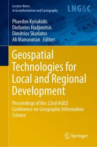
May 2019 — Springer book with AGILE 2019 full papers is now available
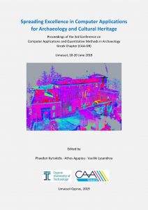
April 2019 — 3rd CAA-GR Conference Proceedings are now available on-line
June 2018 — CAA-gr Conference: June 19-20, in Limassol, Cyprus

